Death Stranding is the first game I have ever played to basically have two maps: one in theory, and one in practice. The game takes place in America, a fact that none of the characters want you to forget, but it isn’t really America, is it?
What I mean is, I walked 1,200 meters (give or take), but somehow I managed to walk from Washington D.C. clear to Tennessee. For an accurate figure describing that distance, Memphis is 873 miles from D.C., which, once converted, equals around 1,404,657 meters. No one wants to walk that, especially not when carrying 80 kilograms of ceramics.
With the math out of the way, hopefully, now you see why I think there are two maps. One is the real, physical map that you walk across while delivering packages; the other is America, the idea of what the physical map is actually supposed to be.
So why, when I’m out delivering packages, do I still feel like I’m walking all the way from Memphis to D.C.? The actual map that we have access to stills feels gargantuan. Here’s how Death Stranding pulls that off.
Scale
Consider first arriving to Lake Knot City. It’s dark, and the land is fairly flat, so you can see for quite a distance, except for the massive wall to the right. The wall has lights atop it, on construction that is still taking place, but the wall is massive.
The scale of the city compared to the world you are in is a large part of why the map feels so huge. You know there is a massive city behind you, but you can walk so far in the other direction the huge, imposing wall, is just a speck on the horizon.
This also stands for the broad mountain ranges and the vast lakes as well; the game creates a sense of hugeness that surrounds and almost engulfs Sam Porter Bridges on his cross country trek. It makes the world feel… big.
Verticality
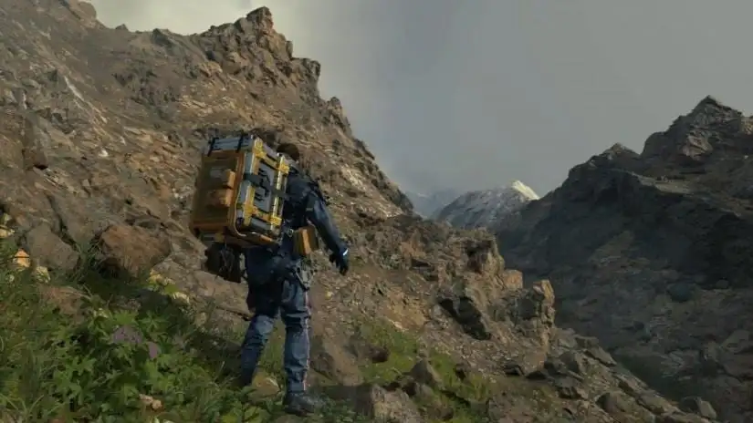
I have stumbled from a small ledge, spilling all of my goods across a mountainside more than once. The mountains are frustrating, but they are also important in making the game feel as imposing and large as it is.
Climbing mountains and walking across flat plains take the same amount of time, and while a flat plain shows you how much further you have to walk, the mountains hide the expanses behind them.
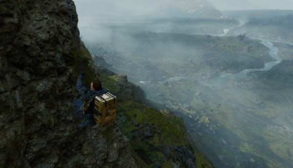
Summiting a mountain to see the landscape beneath you is one of my favorite things Death Stranding does.
These mountain ranges keep the player occupied, makes them feel like their moving without making any real forward progress.
Road-Building
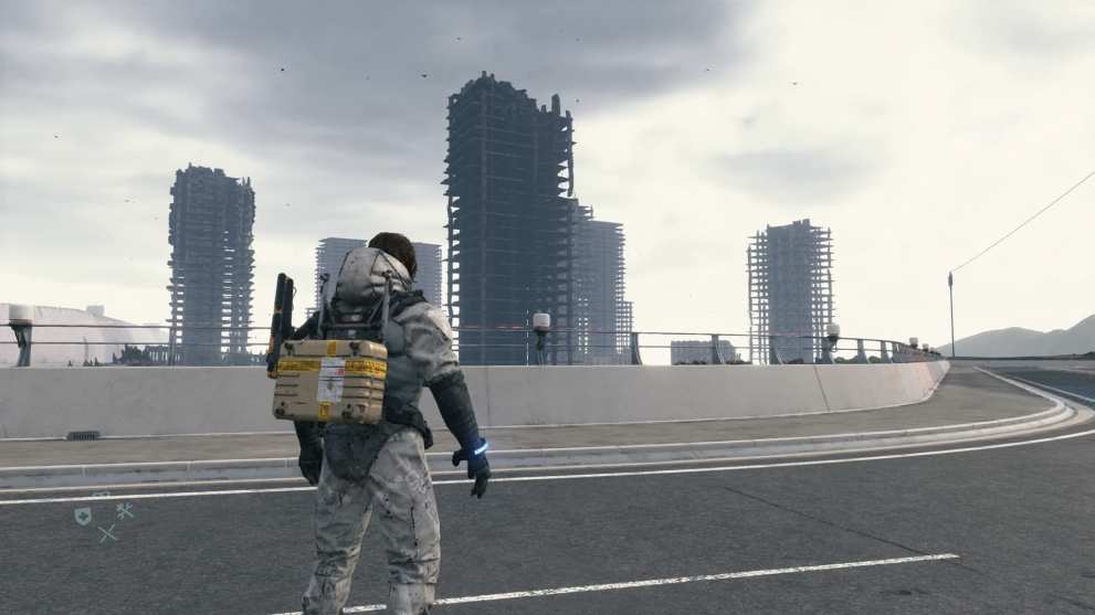
The real heroes of Death Stranding are the roads. Once you set out in Chapter 3, the terrain is unforgiving and rocky, the MULEs are everywhere, and there are people scattered all over the place. It’s a mess.
You start building roads, and all of that stress disappears. The map doesn’t get smaller, but it certainly comes together. A highway that connects people (in Death Stranding, imagine that) makes the world flow.
You see all of the places that gave you trouble, the vast expanses you crossed on foot, and you see how big the world was. Then you reach the end of the road and… it just keeps going. The roads are a massive help, but they just let you scratch the surface. Even when you can move freely, there is always more.
The map in Death Stranding gets in your head. It isn’t America, it can’t be. I can’t actually walk from D.C. to Tennessee in 20 minutes, but in practice, it can feel like you did. The map isn’t as big as America, not really; it just tricks you into thinking it is.
If you need any help while playing through Death Stranding, make sure to check out our extensive guide wiki. You can also read our review right here as well.


Updated: Nov 14, 2019 02:40 pm