


HBO’s blockbuster Game of Thrones franchise has become a bonafide phenomenon, with its legend stretching out past even the original series and finding success. As its prequel, House of the Dragon, wraps up its first season, fans are looking for some direction while they wait for Season 2. Luckily, thanks to Twitter user House of the Dragon Source, there’s a (Google) map for that.
If that last sentence confused you, fret not! We had to do a double-take, too. A Google Maps version of a fictional continent? Well, it’s real, and you can see it below.
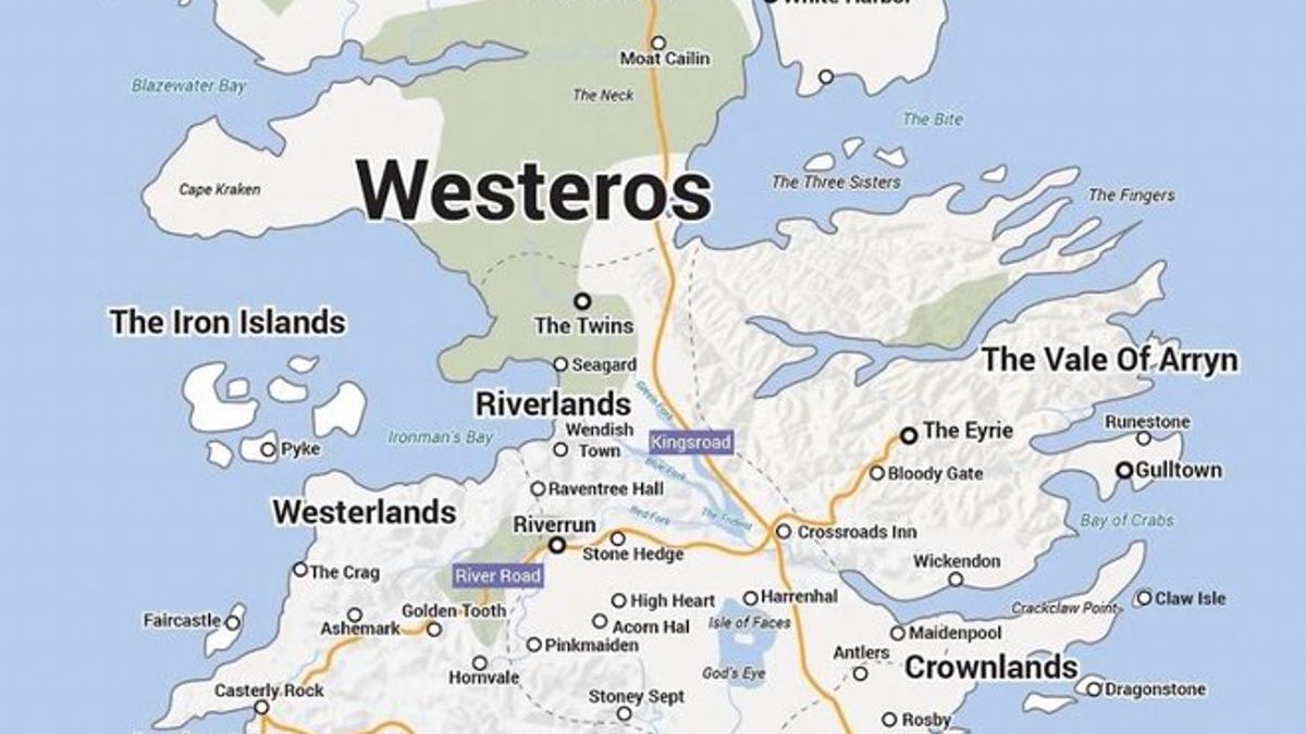
Unsurprisingly, the map is incredibly detailed and somewhat overwhelming at first glance. Given closer consideration, however, it’s clear that it’s organized clearly and logically. The major roads/paths connecting Westeros are encased in purple bars to distinguish them from city/village markers.
The map’s handy color-coding enables even the most casual Game of Thrones fans to read it easily, making it far more than just a cool thing someone made on the internet. It can actually serve as a visual guide to Westeros and its various locales.
If you look closely, you can see many familiar names: King’s Landing, Winterfell, The Twins, and The Riverlands. It’s a solid visual tool that can make the tricky business of piecing together Martin’s world less daunting and more fun.
The creation of a Google Maps Westeros begs the question: How else will fans find ways to bring fictional worlds into our reality?
About the author

